Thursday, July 13, 2006

Bomber Rams Skyscraper

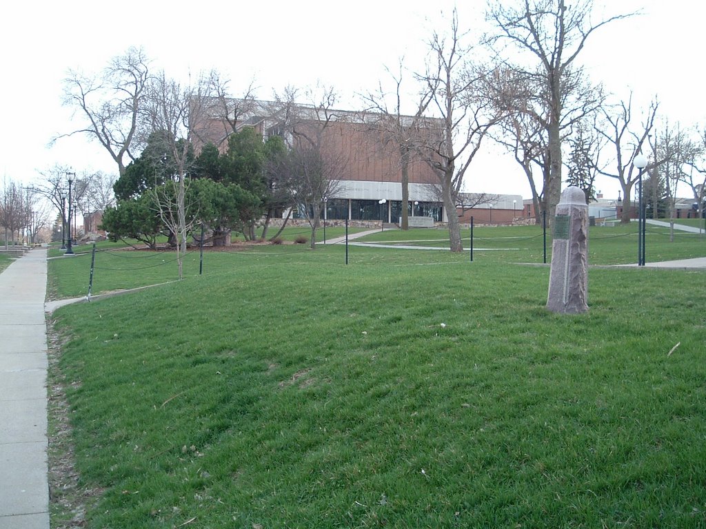
There are a number of historic site markers around Joe Foss Field, the primary airport in Sioux Falls. Joe Foss Field is now home to the 114th Fighter Wing of the South Dakota Air National Guard, but during World War II it was known as the Sioux Falls Army Air Base.

The Army Air Base was home to thousands of soldiers during the war, and added much to the city's history; one such incedent is recorded on a marker just outside the main gate of the Air Guard base:


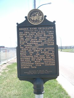
BOMBER RAMS SKYSCRAPER

Following victory in Europe during World War II, the Sioux Falls Army Air Base became a reception center for airmen returning to be redeployed to the war in the Pacific. A twin-engine B-25 bomber, Army 0577, was added to the base fleet. Christened Old John Feather Merchant, the bomber was outfitted as a VIP ferry plane.

On July 28, 1945, Army 0577 was returning to Sioux Falls from the East Coast when the pilot became lost in a blinding fog. Traveling 250 mph, the 12-ton bomber slammed into the 78th floor of New York's Empire State Building, then the world's tallest building. The point of impact was 975 feet above street level. Highly flammable aviation fuel exploded, unleashing a deadly fireball inside the skyscraper.

Killed in the tragic collision were the plane's 3 occupants and 11 people at work in the building. Concluding that fault for the accident was largely that of the pilot, the Army thereafter required more intensive transitional training for pilots returning from overseas combat duty.

DEDICATED IN 2001 BY THE
MINNEHAHA COUNTY HISTORICAL SOCIETY
AND THE CITY OF SIOUX FALLS


I had read about that accident before, and was surprised that there is a Sioux Falls connection. From what I remember of the story, there was much fear following the accident that the Empire State Building might collapse. But I guess they built 'em tough in those days, and it still stands today.

Edit: Thought I'd add a couple of links with pertinent information on the event memorialized in this marker. The "Official Website of the Empire State Building" has an article on the event (link), and Damn Interesting has a story about it as well (link). DI also hosts a recording of a Mutual News radio broadcast about the accident. Makes you feel like you were there!

It's interesting to note the discrepancy between the story told in this marker and that told by DI and the Empire State Building website. The marker states that the plane "was returning to Sioux Falls from the East Coast", but the others say that the plane was enroute to Newark, NJ, to pick up the CO of the Army Air Base. I think the latter is the more likely case, as it was only the pilot and two crewmen who were on the plane when it crashed. Not that the story told on the marker is likely to be revised or updated any time soon, but...

Saturday, June 17, 2006

In Memory of Makana Na Ota E 'En

Here's a marker marker near an old haunt of mine; Terrace Park Swimming Pool and Covell Lake.


In Memory of Makana Na Ota E 'En
Ennraged over the broken promises of the white man, the Santee Sioux, led by Chief Little Crow, launched the "War of the Outbreak" - or "Dakota War" -- in August, 1882, along the Minnesota River. Little Crow ordered White Lodge's band, camped near Lake Benton, Minnesota, to drive out the settlers along the Dakota border and in the Big Sioux River valley.
On August 25, 1862, Judge Joseph B. Amidon and his son, William, were slain by Indians while making hay near the north edge of Sioux Falls. Territorial Governor William Jayne ordered evacuation of the settlement. Following the Yankton Stage Trail, the settlers fled to Yankton, led by a detachment of Dakota Cavalry.
In November, a scouting party under Captain Nelson Miner returned to Sioux Falls. Included in the party were a number of civilians who had been residents of Sioux Falls before its evacuation. Many of the civilians had chached goods which they how wished to recover. Using caution, the scouting party camped overnight on the south side of the Big Sioux River near the present location of the Yankton Trail Bridge. They continued at dawn and when "they reached the top of the south hills" (present day 14th Street between Dakota and Minnesota Avenues) they not only discovered the settlement burned and in ruin, but also sighted a band of Indians near the Falls.


On signal, the cavalry charged. The Indians scattered to the north and west and escaped, save one man, who missed the unmarked trail crossing Covell's Slough and whose horse floundered in the mud near this spot. Soldiers fired and wounded him. Injured and on foot, he was killed by a mounted soldier's saber slashes. The cavalry reported the slain man to be Wa-keyan-doota, a nephew of the notorious renegade, Inkpaduta.
The Indian killed was not Inkpaduta's nephew. He was Makana Na Ota E 'En, which could be translated to Among Many Little Trees. He was a member of the visiting band who had no part in the Amidon murders or the sack of Sioux Falls. His only crime was being an Indian. Later his companions returned and buried him near the top of a nearby high point.
Years later, in 1931, his true identity was related by his sister, Rattling Wings Woman. For some time, she unsuccessfully sought the burial place of her slain brother. It is thought that the unmarked grave of Makana Na Ota E 'En is in upper Terrace Park.
Makana Na Ota E 'En, like the Amidons, was a tragic casualty in the eddies of violence surrounding the Dakota War.
Erected in 1993 by the Minnehaha County and South Dakota
Historical Societies, the Minnehaha Century Fund and
the Mary Chilton DAR Foundation

Wow. The policy of "shoot first, ask questions later" really sucks. I wonder how different things would be in this area — this country — if we had taken the time to not only talk but communicate, and live up to our agreements.
It's probably a good thing that this marker wasn't put up until 1993, otherwise I, along with every other North-End kid, would've been digging holes all over Terrace Park looking for this guy's bones.
And yet another reference to the Amidon murders. Was it the fact that Joseph Amidon was a judge that caused people to react the way they did? Or maybe it was the way Joseph and William were killed; from movies and TV we get the impression that that sort of Indian-on-white attack was common. Perhaps it wasn't at all common, and the fact that the Amidons were attacked without provocation caused the people of Sioux Falls to strike back in this way.

West Sioux Falls

Here's a marker found near the Elmwood Park ball diamonds in northwest Sioux Falls (Google Maps link.)


West Sioux Falls
In March 1889, several months before South Dakota achieved statehood, Evan B. Meredith, first president of the University of Sioux Falls, platted a future residential community within the northwest boundary of early Sioux Falls. His purpose was to raise funds through land sales for the struggling school. The area quickly became known as West Sioux Falls.
The intersection of present day Burnside and Madison Streets and Lincoln Avenue was its focal point. Prior to 1900, the growing community included several modest homes and farm buildings, Beuhlah Baptist Church, Meredith School, Edson Grocery and wooded Meredith Park. The earliest residents hauled water from a small shallow well next to the grocery store which was soon replaced by a larger community well located at the northwest corner of Bailey Street and Garfield Avenue. Industrial and agricultural businesses were established west of the Big Sioux River. Despite the economic hard times which followed the Panic of 1893 and which existed into the new century, the community continued to grow.
Following World War I, the surrounding flat grassy fields served as makeshift landing sites for barnstorming aviators. Thrilling air shows included stunt flying, wing-walking, parachute jumps, and aerial acrobatics. In 1920 a 40 acre West Soo Amusement Park was opened in the former Meredith Park. The up-and-coming Lawrence Welk Orchestra and other musical groups regularly played for public dances held in the dance pavilion.


A spectacular display of fireworks each Fourth of July, ball diamonds and regularly scheduled semi-pro baseball games, a shaded picnic area and fishing and swimming in the Big Sioux River drew large crowds to the park. Scenic Elmwood Park was established in 1924. It extended north of the residential community and is now an integral part of the 18-hole Elmwood Municipal Golf Course.
For many years, an impressive collection of mounted wild animals was displayed at West Sioux Hardware. The trophies were collected by Henry Brockhouse, a long-time community businessman and resident and an avid sportsman. His safari hunting expeditions covered a period of 35 years and spanned four continents. Generally regarded as the largest private collection in the world, it was sold in 1985 and became a major attraction at the Delbridge Museum of Natural History at the Sioux Falls Great Plains Zoo.
Beuhlah Baptist Church, more than a century old, together with several early homes, and the florist greenhouse remain at their original locations. The quartzite stone quarrying business has vastly expanded. This varied arrangement of business, cultural, and recreational undertakings circling residential West Sioux Falls confirms the unique importance of this area which has flourished for over 100 years.
Dedicated in 1996 by the
Minnehaha County and South Dakota State Historical Societies,
University of Sioux Falls, the Amby & Viola Westendorf Family, Dust-Tex Services, Inc., Descendants of Henry W. Smith Family, and the Feay Family.

I remember going to West Sioux Hardware as a kid, and marvelling at the animals on display there. There seemed to be an endless string of rooms filled with the trophies; enough to keep a kid more than busy for however long it'd take for Dad to take care of business up front.
Other than the old hardware store, and the fact that I was once employed near the West Sioux area, I don't feel much of a connection with the area. Mom & Dad would talk about the days of going to the West Sioux Pavilion (I think that's what it was called) for dances and whatnot, but these days it's just another neighborhood. But I guess every neighborhood has some history behind it.

The Old Yankton Trail and Stage Road


Here is preserved a section of
THE OLD YANKTON TRAIL
AND
STAGE ROAD

Over this trail the people
of Sioux Falls fled to Yankton
under cavalry escort for
safety from hostile
Sioux indians, Aug. 28, 1862.
This tablet placed by Sophomore
Class of 1926 Sioux Falls College.
Auspices
Minnehaha County Historical Society


This is the oldest marker I've yet seen, placed in 1926. The second photo doesn't really give a good sense of what is there; the remnants of the ruts left behind by wagon wheels and horse traffic. The site is located on the campus of The University of Sioux Falls (formerly Sioux Falls College.) I'm not aware of any other undisturbed sections of the old trail, but there is a street named Old Yankton Trail Road that presumably follows the original. I would imagine that there are other sections of the original in more remote regions that have survived.

Amidon Graves Mystery

Here is another marker about the death of the Amidons and the mystery of their final resting place. This marker is within sight of the grand Pioneer Memorial monument (Google Maps link.)


Amidon Graves Mystery
About 200 yards southwest of this marker is the location long supposed by historians to be the burial site of Judge Joseph Amidon and his son William, ambushed and killed by Santee Sioux warriors on August 25, 1862. The Sioux war party was under orders to clear all settlers from the Big Sioux River valley.
For decades the belief was held by many that the Amidons had been interred near where they fell. A linear earthen mound, about 30 feet long, eight feet wide, and four feet high, strewn with rocks and large boulders, was understood to mark their gravesites.

In 1991 the Augustana College Archeology Lab was employed to excavate the presumed burial mound. A crew led by archeologists Dr. L. Adrien Hannus and Peter Winham methodically extracted nine soil core samples, dug four one-meter square excavations, and cut a 21-foot long backhoe trench. No evidence of human interments was found; only debris piled up by farmers for almost a century was uncovered. The location of the Amidon graves remains a mystery.

Dedicated in 2001 by the Minnehaha County Historical Society and the Sioux Falls Development Foundation, Inc.


It seems a bit strange to me that the digging referred to here took place at all when there was a first-hand account from one of the Cavalry soldiers that the bodies were buried "... in a cemetery ...(on what is now)... North Duluth Avenue." I guess this is a case where local legend overrides what is known through written documents.

But you know, I grew up in the area near North Duluth Avenue, and I don't recall ever seeing a cemetery there. I wonder what happened to that place. Hmmm.

Friday, June 16, 2006

The Pioneer Memorial, and The Amidon Affair

This marker is probably one of the grandest in the city, because of its location and because of the monument at the same site. First the story, as told by the markers at the site.


The Amidon Affair

The 1862 Sioux Uprising, a result of unjust government treatment, claimed many Indian and non-Indian lives. Near this place on August 25, 1862, two of its victims, Judge Joseph B. Amidon and his son, William, were killed while making hay on their claim which was a mile north of their cabin in Sioux Falls.

Amidon was a County Probate Judge, Treasurer and Commisioner appointed by Governor Jayne and the Territorial Legislature. When he and William failed to return home at sundown, Mrs. Amidon became alarmed and sought help from the Dakota Calvalry (sic) detachment in the village. A search was to no avail, but the bodies were found in the morning. Joseph died of a single bullet wound. William was riddled with arrows.

George B. Trumbo brought their bodies back to the village. Later, Sg. Jesse Buel Watson, Company A, Dakota Cavalry, reported, "We picked up the bodies and buried them in a cemetery ...(on what is now)... North Duluth Avenue."


In the opinion of John Renville and Joseph Laframboise, veteran fur traders and plainsmen, the Amidons were slain by members of the band of the warrior White Lodge. He was under orders from Chief Little Crow, Indian leader in the "Dakota Ware", to drive white settlers from the Sioux Valley. Pure chance placed the Amidons in the path of White Lodge's scouting party.

Two days later, orders came by courier from Governor William Jayne to abandon Sioux Falls and seek shelter at the Territorial Capitol at Yankton. Settlers and soldiers together hastily set out in a wagon train before sundown.

Following the settlers' flight to Yankton, Sioux Falls remained abandoned until the establishment of Fort Dakota by federal troops in 1865, when settlement was resumed.

Joseph B. Amidon was born in Connecticut in 1801. He came to Sioux Falls from Saint Paul, Minnesota, with his wife Mahala, son William and daughter Eliza, sometime before 1860.

Erected in 1991 by the Minnehaha County Historical Society, the South Dakota State Historical Society and the South Dakota Department of Transportation.


The marker is located on the edge of a bluff overlooking the Big Sioux River (Google Maps satellite view). I don't know why the Amidon's chose this spot for their hay field, but if it were me settling the area back in 1860, I certainly would've built my home there, just for the view. Unfortunately, time and the development of Sioux Falls has not been kind to this spot, for just down the hill to the south is the waste water treatment plant retention ponds and the John Morrell meat packing plant. To the east is Barney's Auto Salvage, an eyesore from the ground and the air. And just around the bend to the west is the South Dakota State Penitentiary. If not for those four facilities, this area would be the most desirable residential property in eastern South Dakota.

I've long wondered what it was about the deaths of the Amidons that made the event worthy of monuments like this, because there were many early settlers who died either at the hands of Indians or any number of other causes. But in reading the story, the event was apparently the catalyst which led to the evacuation and the 3-year abandonment of the Sioux Falls settlement. That was a major event in the history of the city.


The bronze marker is accompanied on the site by a huge granite obelisk that was erected in 1949. A plaque on the monument reads as follows:

MEMORIAL TO THE PIONEERS
OF
MINNEHAHA COUNTY
1856 -- 1889

ERECTED BY THE
MINNEHAHA COUNTY
HISTORICAL SOCIETY
1949


Another marker, made of engraved granite is mounted at the base of the obelisk, and reads...

The Pioneer Memorial
Honors the early settlers who faced the harsh and lonely prairie, the ferocity of the elements, and the uncertainty of their fate in this new land between 1856 when Sioux Falls city was platted and 1889 when South Dakota achieved statehood. They built homes, farms and businesses and planted their family roots in Minnehaha county. This Sioux Quartzite obelisk was erected in their memory in 1949.
1999
Minnehaha County Historical Society


Seems odd that the MCHS would see the need to expand on the original plaque on the obelisk. I sometimes fancy the idea of being a settler in this area back in the mid-1800's, but I don't know if I would've fared very well. Those that did were made of tougher stuff, and they deserve our admiration.

Monday, April 17, 2006

Frederick Manfred's "Siouxland"

I've never read any of Manfred's works, and know little of him. A Google search yields a lot of information on the man, and here is what the bronze plaque at the north end of Falls Park has to say about him:


This spot is near the center of an area called "Siouxland," so named by writer Frederick F. Manfred (1912-1994). Manfred established a distinct identity for this region, the drainage basin of the Big Sioux River. It includes parts of Iowa, Minnesota, Nebraska and South Dakota. Manfred was born on an Iowa farm and christened Frederick Feike Feikema VII. He chose to live in Siouxland after years in politics and journalism in Minneapolis. His home was at thte south edge of Blue Mound near Luverne, Minnesota, on the side of what was once an ancient mountain range that stood 30,000 feet above sea level. From his writing tepee atop his house, Manfred could see far across the landscape of Siouxland.

For Manfred, Siouxland contained no rigid state boundary lines. Rather, he envisioned it as an area with distinct social, cultural, and economic values that made its people unique. His writings often reflect his farm upbringing and echo the voices of the farmers, who as settlers, began learning the hard, enduring lessons of the land over a century ago. The voices of native Sioux Indians are heard as well in several of his books, including Lord Grizzly (1954), Conquering Horse (1959), Scarlet Plume (1964), and The Manly-Hearted Woman (1975). Manfred concurred in the Indian beliefs that all people are one with the land and that the land and all life are connected and "wakan," or "holy." Thus Siouxland was "holy land."


Many of Manfred's novels are set in Siouxland. This is the Year (1947) deals with a man's treatment of farmland southeast of Sioux Falls. Conquering Horse is set in Minnehaha County when it was tribal land. It is the story of No Name, a young Yankton Sioux brave, who camps by the "river of the Double Bend" (the Big Sioux River), takes hsi ritual bath at "Falling Water" (the Falls of the Big Sioux), makes his vision quest, and returns victorious , as "Conquering Horse," chief of the Yanktons.

Frederick Manfred illustrated his love of Siouxland and his belief in its uniqueness and importance in his fictional place names and in his personal involvement. He taught at the University of South Dakota (1968-1984) and was a consultant in the Humanities at Augustana College in Sioux Falls (1984-1994). In both his writings and in his life, Siouxland becomes "holy land."
DEDICATED IN 2000 by the MINNEHAHA COUNTY HISTORICAL SOCIETY
AND THE CITY OF SIOUX FALLS

The Dubuque House

I know nothing more about this site than what is on the plaque. The plaque is located in Falls Park, near the Horse Barn Art Museum (Google Maps link.) Here is what it says:
The Dubuque House, Sioux Falls' first hotel, was built about 350 yards due wewst of this spot by Wilmot w. Brookings and members of the Western Town Company of Dubuque, Iowa, in September 1857. In the previous year, they had staked out a 320 acre claim and established the town of Sioux Falls, Minnesota Territory, on the west side of the Big Sioux River. The new town-site was northwest of a large wooded island, originally called Brookings but later renamed Seney.

Although Dubuque House was built for visitors and prospective settlers, it may have also served as a meeting hall, freight station and post office. It appears in the field notes and on the first map of Sioux Falls made by a federal surveyor in Augus, 1859, the only building shown within the town-site.

The primitive hotel was built of rough undressed blocks of Sioux Quartzite, found in the stone outcroppings which surround the Falls of the Big Sioux River. No photographs or sketches of the hotel are known to exist, but it was probably a rough rectangular-shaped structure featuring a single open room with a loft above and a cellar below. Sleeping accomodations were crude, with cloth sack mattresses filled with prairie grasses on rough wooden cots or on the floor, with animal skins and blankets for covers.


Since the settlers had a steam-driven saw mill, we can assume that the roof was probably made of rough boards and light wooden poles covered with thatch and dirt, much like settlers' cabins. Windows were small and covered with cloth or skins. Oil lamps provided any interior lighting. There probably was not an innkeeper in residence; whether visitors paid for sleeping space is uncertain. But the existence of the Dubuque House enabled the town promoters to assure the world that the new city did indeed have a new hotel!

With the rest of the town, Dubuque House was abandoned in the Dakota War of 1862 and probably burned by the Santee Sioux. When Fort Dakota, D.T., was established in 1865 at what is now the northeast corner of Phillips Avenue and Eighth Street, the Sioux Falls town-site was included within the boundaries of the 70 square-mile military reservation surrounding the Fort. Not until Fort Dakota was closed in 1869 was the military reservation reopened for civilian settlement. The remains of the Dubuque House were razed and the stones were probably used to begin the construction of teh Stevenson Hotel near the intersection of North Main Avenue and Falls Park Drive. Although that hotel's walls were erected, the building was never completed. However, in 1874, stone from the unfinished Stevenson Hotel was used nearby for the construction of the city's first brewery.

DEDICATED IN 1997 BY THE MINNEHAHA COUNTY AND SOUTH DAKOTA STATE HISTORICAL SOCIETIES, MINNEHAHA CENTURY FUND AND BLAKE LAW OFFICES


Thursday, April 13, 2006

The Queen Bee Mill


The Queen Bee Mill, a goliath among mills in early Dakota Territory, once stood tall and proud here on the bank of the Big Sioux River. A large quartzite deposit on the site was used to build an impressive seven-story flour mill.

The building of the mill was the result of the work of many people, led by R. F. Pettigrew of Sioux Falls. Pettigrew, one of the leading political and business figures of the city, secured money to construct the mill from a group of investors led by George I. Seney, a New York City banker. It has long been believed, though unproven, that Pettigrew tricked Seney into putting up the money. According to that legend, Pettigrew arranged for the construction of a dam upstream on the Big Sioux River, and as the men approached the river, on signal, the dam was broken. The resulting flow of water over the falls was sufficient to convince Seney that the mill should be built.

In August 1879, construction began on an 81-acre site that was purchased for $38,000. After two years of building and fitting, the Queen Bee was ready, at a cost of nearly half a million dollars. It was 104 feet tall, 80 feet wide, and 100 feet long. Water from the Big Sioux River was diverted into a large turbine which generated 800 horsepower. The Queen Bee Mill, known as "the most ambitious attempt ever made to use waterpower west of the Mississippi River," was capable of producing 1,200 barrels of flour daily. One hundred men worked within and around the mill complex.


The very river which was to provide the source of power to operate the mill also threatened to destroy it before the first wheat was ground. On April 20, 1881, spring run-off from melted snow and ice overflowed the banks o fthe Big Sioux River, creating the worst flood in the recorded history of Sioux Falls. The mill took a pounding, but, as it was built of "a stone that is unsurpassed by any building material that exists in the world," it withstood the onslaught of the raging river with damage limited to mill offices.

The Queen Bee Mill began grinding Dakota spring wheat October 25, 1881. By early 1883, owing $97,000 to creditors, the mill was bankrupt. It failed because of insufficient waterpower, the scarcity of high grade wheat and the inability to pay dividends to its investors. The mill complex changed ownership several times, then shut down forever shortly after the end of World War I when it became a storage facility.

On January 30, 1956, the Queen died a fiery death. Portions of the walls of the mill, built of "a stone with which it is fitting that
we should find heaven paved," remain to remind future generations of the economic struggles of the past.

DEDICATED IN 1995 BY THE MINNEHAHA COUNTY AND SOUTH DAKOTA STATE HISTORICAL SOCIETIES, CITIBANK, MIDCONTINENT AND MARY CHILTON DAR FOUNDATIONS.


The story of the Queen Bee Mill is fairly remarkable, and it's fitting that it should be the first in my listing of Sioux Falls Historic Sites. I remember my Mom telling me this story, long before the monument was erected in front of the ruins of the mill (so it must be true!) As a kid my buddies & I would play in & around the ruins -- no iron fence to keep you out back then, but there were plenty of rocks and dirt and holes to hide in. I'm sure those holes were home to a few hobos from time to time, but we'd keep our distance.

Actually, I don't doubt that the legend of the scam to get the mill built is true. First is the sheer size of the mill; knowing the usual flow of the Big Sioux, and that it barely rates as a stream during the late summer months, I doubt that there was ever enough water to keep a monster like that running. Then there is the fact that it was built to mill flour. That usually requires wheat, and growing up I don't remember much wheat being grown in the area at all. Lots of corn & soybeans, but no wheat. I asked my Dad about that once, and he said the soil in this area wasn't right for wheat. Sure, I grew up almost a hundred years after the mill was built, but I don't think that the soil would've been much more favorable to growing wheat back then.

You can get a bird's-eye view of the Mill's ruins here, thanks to Google Maps. Scroll around a bit to get a view of the Falls, the spillway, which is just north of the Mill. I've always thought it interesting that the river actually makes a full loop around the city, with the diversion channel and spillway closing the circle; our own moat!

Tuesday, April 11, 2006

Sioux Falls Historic Sites

Pretty creative title, eh? As that title suggests, this blog is all about the many historical sites in the marvelous municipality known as Sioux Falls, South Dakota. Scattered here & there throughout the city are spiffy little bronze historical markers that have been placed by one historical society or another, marking the location of some significant event or landmark of the city's history.

Recently, I was curious as to whether there might exist a central listing of all of the markers in the area, and went looking online for it. Surprisingly there is nothing of the sort to be found. I even contacted the webmaster for the South Dakota State Historical Society, who forwarded my message to the Research Room Administrator for SDSHS, and was told that there was none.

Being the kind of guy that doesn't like to leave needs unfilled, I thought I'd take a shot at putting together a site that includes photos of the historical markers, the transcribed text on those markers, photos of the landmarks (if they still exist) and whatever I can recall or dig up concerning those sites. Today is April 11, 2006, and I took the first photos last night, just getting started. Please don't consider this blog a complete listing of the markers; there are hundreds of these markers, I am doing this in my already sparse spare time, so as I see it this will always be a work in progress.

I've been a resident of Sioux Falls for pretty much my whole life, as were my parents and one set of my grandparents, and over the years have learned a fair bit of the history of the city. If you're reading something on this site and you think it's incorrect or if you have something to add, please post a response. All it takes is a Blogspot account, and signing up with Blogspot is about as easy as it gets.

So, here goes nothin!